All posts tagged: Earth observation

SpaceX Successfully Launches 131 Satellites on Transporter 12 Mission

SpaceX Successfully Launches 131 Satellites on Transporter 12 Mission

SpaceX launched 131 satellites into orbit during its Transporter 12 mission on 14 January 2025. The Falcon 9 rocket lifted off from Vandenberg Space Force Base, California, at 2:09 p.m. EST. This mission added to the company’s rideshare programme, aimed at delivering payloads for multiple customers in a single launch. The first stage booster of the Falcon 9 executed a successful ground landing at Vandenberg’s Landing Zone 4 approximately 7.5 minutes after liftoff. Key Details of Transporter 12 According to a report by space.com, Transporter 12 is the 12th mission in SpaceX’s Transporter series, designed to carry multiple payloads for commercial and government clients. 37 of the satellites on board were from Planet Labs, a San Francisco-based company specialising in Earth observation. These included 36 “SuperDove” cubesats and a single Pelican-2 satellite, designed for high-resolution imaging and equipped with advanced AI-powered solutions to analyse data in near real-time. The mission marked the second flight for this specific Falcon 9 booster, which had previously been used for the NROL-126 mission for the U.S. National Reconnaissance Office. …

NISAR Satellite by NASA and ISRO to Monitor Earth Like Never Before

NISAR Satellite by NASA and ISRO to Monitor Earth Like Never Before

A collaboration between NASA and the Indian Space Research Organisation (ISRO) has resulted in the NISAR (NASA-ISRO Synthetic Aperture Radar) satellite, which is set to launch in a few months. This mission, designed to track and monitor Earth’s dynamic surface, will use synthetic aperture radar technology to measure changes in land and ice formations. Capable of delivering precise data down to centimetre-level accuracy, NISAR will contribute significantly to understanding natural disasters, ice-sheet movements, and global vegetation shifts. Unique Dual-Band Technology According to an official press release by NASA, NISAR is equipped with two radar systems: the L-band with a wavelength of 25 centimetres and the S-band with a 10-centimetre wavelength. This dual-band configuration enables detailed observations of various features, from small surface elements to larger structures. These advanced radars will collect data frequently, covering nearly all land and ice surfaces to provide a comprehensive view of Earth’s transformations. Technology and Data Applications As per reports, synthetic aperture radar technology, first utilised by NASA in the 1970s, has been refined for this mission. The data from …

ISRO and NASA to Launch NISAR Satellite in March 2025 for Earth Observation

ISRO and NASA to Launch NISAR Satellite in March 2025 for Earth Observation

American space agency NASA and the Indian Space Research Organisation (ISRO) are scheduled to launch the NASA-ISRO Synthetic Aperture Radar (NISAR) satellite in March 2025, as per multiple reports. The mission, estimated at Rs. 5,000 crore, aims to advance Earth observation capabilities globally. Reports indicate that the satellite, weighing 2.8 tonnes, will track planetary changes with precision and will scan nearly all of Earth’s land and ice surfaces every 12 days. Its dual-frequency radar technology is expected to deliver unprecedented data accuracy. Mission Features Advanced Radar Technology The NISAR satellite incorporates synthetic aperture radar (SAR) technology, enabling it to capture high-resolution images regardless of weather conditions or lighting. According to the official blog of NASA, its radar can detect surface changes as small as one inch and penetrate dense vegetation, making it a vital tool for mapping ecosystems and monitoring land dynamics. The dual-frequency radar combines NASA’s L-band and ISRO’s S-band, offering enhanced precision in data collection. Launch and Operational Details As per reports, ISRO’s GSLV Mk-II rocket might carry the NISAR satellite into a …

Space start-up Pixxel unveils hyperspectral satellite constellation the Fireflies

Space start-up Pixxel unveils hyperspectral satellite constellation the Fireflies

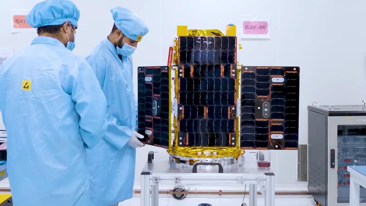
Pixxel Unveils the Fireflies the World’s Highest Resolution Hyperspectral Satellite Constellation. | Photo Credit: SPECIAL ARRAGEMENT Pixxel on Wednesday unveiled Fireflies, their flagship commercial satellites. The Bengaluru based space start-up which specialises in hyperspectral imaging and Earth observation is expected to launch the Fireflies which are a constellation of six next-gen hyperspectral satellites. The Fireflies will offer unmatched precision with their native five-meter resolution, more than 150 spectral bands, and a 40-kilometre wide swath that enables the constellation to access any part of the globe on a daily basis. “The Fireflies constellation will deliver critical data across various applications, from early detection of crop diseases and pinpointing water stress to real-time deforestation monitoring and tracking ocean pollution. With its unparalleled imaging capabilities, Fireflies is positioned to become an invaluable tool in the fight against climate change, enhancing food security and supporting sustainable resource management,” Pixxel said. “This constellation marks a major milestone in Pixxel’s mission to make detailed and actionable insights about the planet accessible to all. Fireflies is built to capture the world in …