Operation Sindoor: Satellite images show how India targeted underground facilities at Pak’s Murid airbase
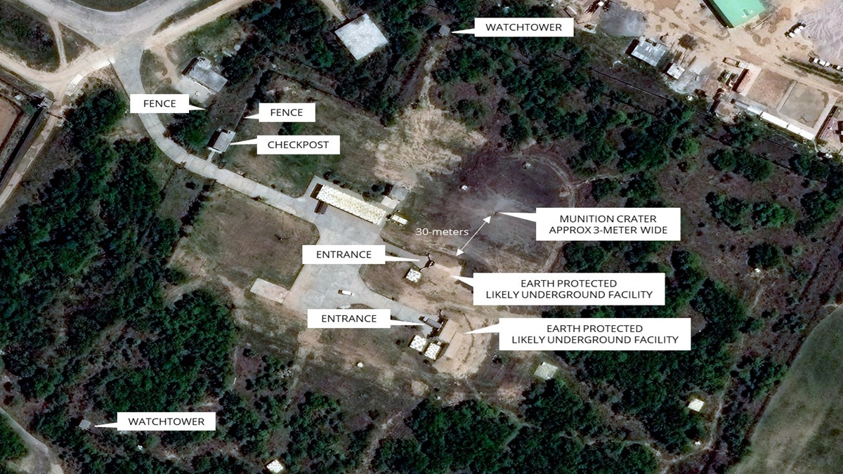
The satellite images captured by Maxar Technologies showed a nearly 3-metre-wide crater just 30 metres from the entrance of a heavily fortified sub-complex within the Murid Air Base—an area protected by double fencing, watchtowers, and tight security protocols. New Delhi: The airstrikes during Operation Sindoor on Pakistan’s Murid Air Base might have targeted a suspected underground facility, newly released high-resolution satellite images showed. High-resolution satellite images on Wednesday revealed extensive damage to the Murid air base in Pakistan, showing a three-metre-wide crater just 30 metres from an underground facility of the Pakistan Air Force and damage to the rooftop of a structure adjacent to unmanned aerial vehicle hangars. The satellite images captured by Maxar Technologies showed a nearly 3-metre-wide crater just 30 metres from the entrance of a heavily fortified sub-complex within the Murid Air Base—an area protected by double fencing, watchtowers, and tight security protocols. As per the updates from Damien Symon, geo-intelligence researcher at the Intel Lab, the crater’s proximity to what is believed to be an underground structure has raised speculation …